From Apache Junction, it's a 2 hour drive to Prescott, Arizona. The I-17 leads steadily uphill until you see the last of the saguaro cacti, finally we topped out .
The highway into Prescott is choc-a-bloc with big box stores, including, for example 3 giant pet supply stores within a ten-minute drive, but as soon as we turned off onto the road to our campsite at Lynx Lake it was instant national forest, ponderosa forest, quiet roads.
After setting up we drove down the road to the Lynx Lake ruins, a short hike up to a platform looking over:
a pile of rubble. But there was a great view of the surrounding area, including, unfortunately, rampant development with hotels and housing developments topping many of the hills.
Also some pretty flowers,
blooming desert caenothus,
and this western scrub jay posing at the top of a tree
Bird of the day!
Prescott is at 5000 feet so it's definitely not the Sonoran Desert anymore. In the evening a big storm arrived and blew tumbleweeds and plastic bags across the highway. We just got back to camp in time before a big rainstorm began.
Sunday, April 9, 2017
Thursday, April 6, 2017
Fountain Hills and Rio Verde
On our last day in the Phoenix area, we got lost trying to drive to the Rio Verde. Fort Mcdowell Road seemed to dead end on the Fort Mcdowell Reserve though it later turned out it became a gravel road that looked like a private driveway.
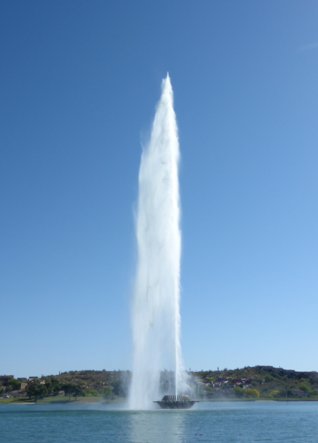
So instead we visited Fountain Hills city park, located in an upscale residential development. Fountain Hills has Arizona's largest fountain, according to its tourist info, and like Old Faithful in Yellowstone, it only goes off every hour.
Much of Fountain Hills' population were out on Sunday morning jogging, playing Frisbee golf, or walking their dogs. Here we witnessed several of the latest thing in pet accessories, the dog stroller

(I'm fake posing on the left so Leo can take surreptitiously take the picture)
The lake was pretty artificial looking, but it's the desert, and wherever there's water, the birds will find it, so there were a few birds around

In the absence of Canada Geese, the coots are doing their job.
And they did have a very nice demonstration xerophytic garden,
and unlike most of our birding destinations, a lakeside cafe where we could sit and have a second breakfast.
Eventually we did find our way to the Rio Verde, and we drove from Forest Service site to site, checking out the birds.

The Rio Verde was high and had recently been even higher, the parking lot was newly graded and some picnic tables were still under water.

Leo birding in the midst of cottonwood fluff.
The trees were full of warblers, kinglets, and Bell's vireos.
In the evening we took our last walk around Lost Dutchman in the golden hour trying to call up a Bendire's thrasher. No luck.
So the bird of the day was the Brewer's sparrow, probably the dullest looking sparrow there is, but nominated today because the bushes were full of them, singing their amusing cricket-like song.
Also our last chance for glamour photos, and possibly for walking about in the evening in shorts since we're headed for the high country!
So instead we visited Fountain Hills city park, located in an upscale residential development. Fountain Hills has Arizona's largest fountain, according to its tourist info, and like Old Faithful in Yellowstone, it only goes off every hour.

(I'm fake posing on the left so Leo can take surreptitiously take the picture)
The lake was pretty artificial looking, but it's the desert, and wherever there's water, the birds will find it, so there were a few birds around
Like this eared grebe

In the absence of Canada Geese, the coots are doing their job.
And they did have a very nice demonstration xerophytic garden,
and unlike most of our birding destinations, a lakeside cafe where we could sit and have a second breakfast.
Eventually we did find our way to the Rio Verde, and we drove from Forest Service site to site, checking out the birds.

The Rio Verde was high and had recently been even higher, the parking lot was newly graded and some picnic tables were still under water.

Leo birding in the midst of cottonwood fluff.
The trees were full of warblers, kinglets, and Bell's vireos.
In the evening we took our last walk around Lost Dutchman in the golden hour trying to call up a Bendire's thrasher. No luck.
So the bird of the day was the Brewer's sparrow, probably the dullest looking sparrow there is, but nominated today because the bushes were full of them, singing their amusing cricket-like song.
Also our last chance for glamour photos, and possibly for walking about in the evening in shorts since we're headed for the high country!
Tabletop Mountain
We had arranged to meet up with two other Williams Lakers who are staying in Yuma for two weeks so we chose the Sonoran Desert National Monument near Gila Bend, about halfway between Yuma and Phoenix.
It was a cool windy day, which was good, because by the time we met and drove into the trailhead down a rough dirt road it was 10 am. As you enter the reserve there are signs about illegal drug activity but there were no signs of any kind of people around for the whole drive. So we were surprised when a Jeep pulled into the trailhead right behind us. Not a drugrunner, just a computer programmer from Phoenix who was just as surprised to see anyone else this out of the way.
It was a long walk across the desert before we even got to the base of Tabletop Mountain; fortunately, it was beautiful desert in bloom, much more arid than we've seen this far with lots of empty space between the cacti and no grasses. Lots of saguaros, very tall and thin.
A little further on we came upon an old lava flow.
Unlike the staghorn cholla we saw at Usury Mountain Park, these ones had reddish flowers.
When we reached the mountain it was steep hairpins all the way to the top.
Near the top the vegetation changed to grassland with banana yucca and prickly pears and pretty bunches of yellow and white flowers.
It took us 3 hours to reach the top and almost as long to figure out how to take a time lapse photograph between our 5 cameras.
Success!
Great views, and for a change, no urban sprawl.
Smog, though, but probably mostly dust after the previous day's windstorms
By the time we got back to the truck we had hiked for 7 hours.
We climbed that mountain!

Two jackrabbits strike the identical pose
We topped the day off by having supper at Sophia ' s Mexican Restaurant in Gila Bend.
Tuesday, April 4, 2017
Usury Mountain Park
And we had the first hour on the trail mostly to ourselves. The first 3 hours of the 4 hour hike were pretty wonderful,
with beautiful desert

and views of mountains in every direction.

The north side was particularly lovely, with patches of blooming larkspur in between the desert plants.

We crossed over two saddles and wandered up and down the slope of the mountain.
The last hour was in flat, drier desert in the full heat,

so it was just a matter of getting back to the parking lot and some shade, but there were lots of staghorn cholla in bloom

in their various shades of yellow.
We hiked all the way around this mountain!
Salt River
As usual, the best birding was in the early morning, we saw a Bullocks oriole (the kind we get in Williams Lake) at our first stop. Bird of the Day!
Also a pair of bald eagles nesting along the river and two black-crowned night herons flew off when we disturbed them.
We drove by a huge empty parking lot, it turned out to be for tubers down the river in the summer.
By about 10 am we were reduced to birding from the picnic Ramada and hopping from shaded mesquite to mesquite; we had left our sun hats behind.

The road ends at Saguaro Dam, with a marina and lots of shaded picnic sites.
Saturday, April 1, 2017
Tempe Lake
Leo had researched potential birding sites in our vicinity, so we visited Tempe Lake Park. We were a little disappointed to find that it was a very urban park right in downtown Tempe, if Tempe can be said to have a downtown. (If any city in Arizona can be said to have a downtown. They are all pretty spread out and low rise with vast strips of mall after mall.)
The lake itself is just a man made reservoir inside the engineered flood channel that is the Salt River. They have made a very attractive linear park along the dikes that is great for runners and dog walker, with a pedestrian bridge.
But it didn't seem to have much riparian habitat. Below the abrupt ending of the lake at the dam within the flood channel we found the riparian habitat, but no way to access it. There were big signs forbidding access downstream of the dam and very steep slopes. We were too high above the trees to get a very good look at the birds. So we walked along the bank till we got to the highway bridge, crossed and returned on the other side. They had done a very nice job of planting the dikes with native and xerophytic plants, and the large irrigated palo Verde trees were covered in yellow blossoms.
And by the time we got back to the pedestrian bridge, we had seen quite a few birds. A roadrunner as trotting down the sidewalk, a red-tailed hawk (Coopers hawk) flew overhead. There were cliff swallow nests under the bridge and we watched them picking up mud for their nests in a puddle created by the sprinkler system (Bird of the Day).
We found a map that showed "Hayden Butte Preserve and it turned out to be a small rocky hill embellished with a large "A" for Arizona State University (located right next to the park).
There is a steep trail leading to the top and we joined the locals out for their fitness walk. There was a fine view from the top of the City of Tempe complete with green roofs and parking garages covered in solar panels.
The peak is a small remnant of natural desert in the midst of miles of suburban development. And there were also the usual desert birds - cactus wrens, thrashers, along with the urban ones - grackles and house sparrows.
We also espied the Corner Bakery and Cafe right next to the Tempe Tourist Information so those were our next two stops.
In the tourist literature we found South Mountain Park, a short drive away, so we headed that way, passing through the small Hispanic municipality of Guadalupe, a little oasis of Mexico now surrounded by the suburban sprawl of greater Phoenix.
The park was another mountain park preserving desert,
(all the flat land in the region is covered in housing), busy with hikers and runners on the extensive trail network, but now it was noon and hot, and the birds were hiding, so we returned to our car and braved Phoenix freeway traffic to return across the city to our campsite and retreat to the shade for the rest of the afternoon.
The lake itself is just a man made reservoir inside the engineered flood channel that is the Salt River. They have made a very attractive linear park along the dikes that is great for runners and dog walker, with a pedestrian bridge.
But it didn't seem to have much riparian habitat. Below the abrupt ending of the lake at the dam within the flood channel we found the riparian habitat, but no way to access it. There were big signs forbidding access downstream of the dam and very steep slopes. We were too high above the trees to get a very good look at the birds. So we walked along the bank till we got to the highway bridge, crossed and returned on the other side. They had done a very nice job of planting the dikes with native and xerophytic plants, and the large irrigated palo Verde trees were covered in yellow blossoms.
And by the time we got back to the pedestrian bridge, we had seen quite a few birds. A roadrunner as trotting down the sidewalk, a red-tailed hawk (Coopers hawk) flew overhead. There were cliff swallow nests under the bridge and we watched them picking up mud for their nests in a puddle created by the sprinkler system (Bird of the Day).
We found a map that showed "Hayden Butte Preserve and it turned out to be a small rocky hill embellished with a large "A" for Arizona State University (located right next to the park).
There is a steep trail leading to the top and we joined the locals out for their fitness walk. There was a fine view from the top of the City of Tempe complete with green roofs and parking garages covered in solar panels.
The peak is a small remnant of natural desert in the midst of miles of suburban development. And there were also the usual desert birds - cactus wrens, thrashers, along with the urban ones - grackles and house sparrows.
We also espied the Corner Bakery and Cafe right next to the Tempe Tourist Information so those were our next two stops.
In the tourist literature we found South Mountain Park, a short drive away, so we headed that way, passing through the small Hispanic municipality of Guadalupe, a little oasis of Mexico now surrounded by the suburban sprawl of greater Phoenix.
The park was another mountain park preserving desert,
(all the flat land in the region is covered in housing), busy with hikers and runners on the extensive trail network, but now it was noon and hot, and the birds were hiding, so we returned to our car and braved Phoenix freeway traffic to return across the city to our campsite and retreat to the shade for the rest of the afternoon.
Thursday, March 30, 2017
Flowers of Tonto National Monument
Here are sme of the flowers we saw at Tonto NationalMonument:
Flowering banana yucca
Indian paintbrush (Castileja exserta)
Desert penstomen (pink) and firecracker penstomen
Mariposa lily
Flat-top buckwheat
Hedgehog cactus
Globe mallow
Marah gilensi (wild cucumber)
Subscribe to:
Posts (Atom)